
As Season 4 of The Handmaid’s Tale comes to an end, let’s take a look at the most recent map showing the borders of Gilead, the United States, Canada, and more. This past season we saw the glimpses of how intense fighting has become in Chicago, but we also saw how easy it is for diplomats to cross the border into Canada for official purposes. It has all left viewers a little confused about just how things look like in this show’s universe. Here’s an update.
An Official New Map Was Shared Just Before the Season Launched
Just before the new season launched, an official new map was shared on The Handmaid’s Tale’s Twitter account.
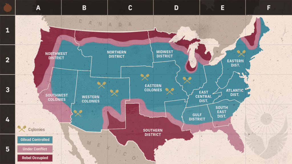
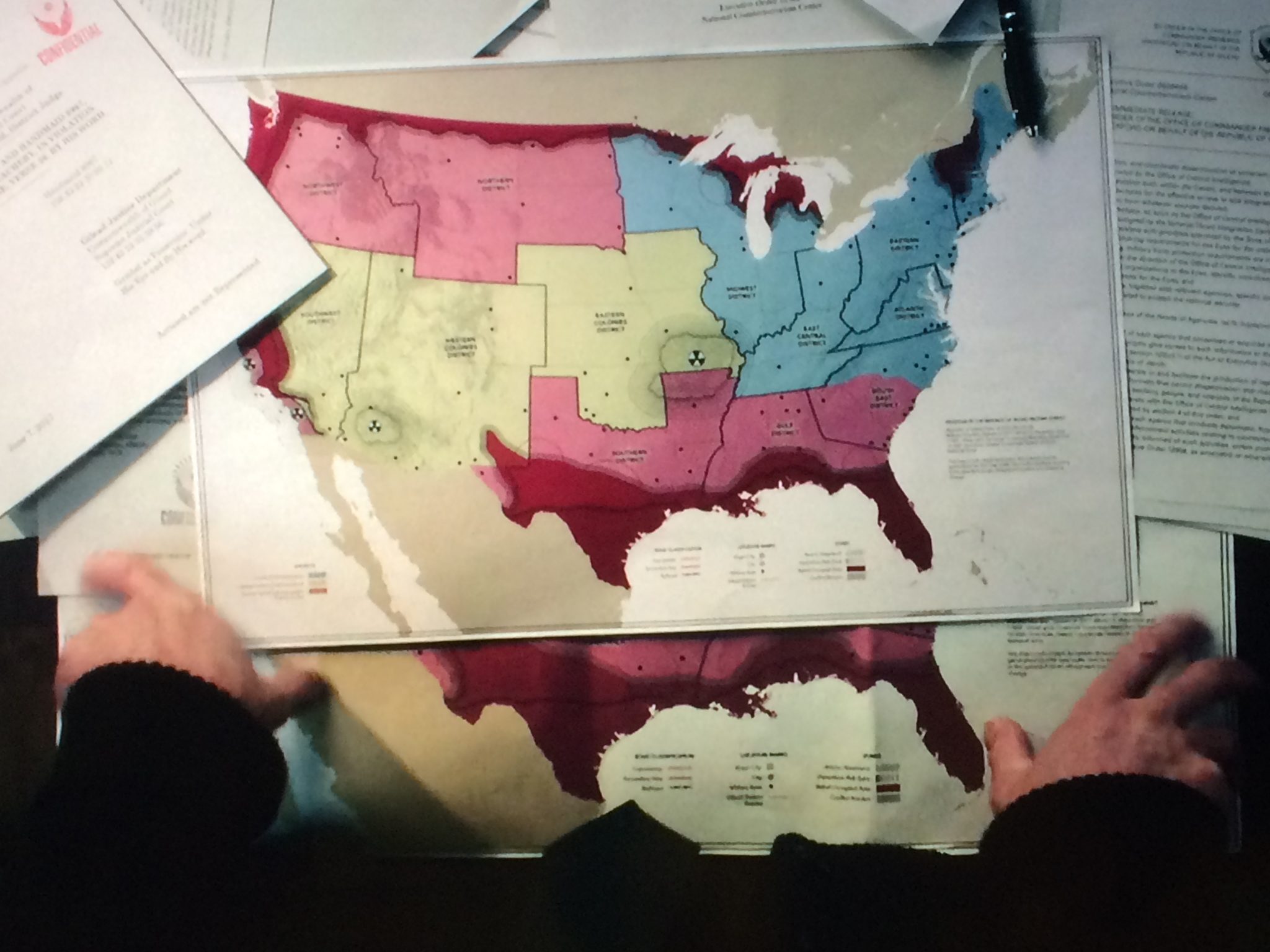
Red indicates areas that are rebel occupied, such as all of Texas and the borders with Canada. Pink indicates areas that are under conflict, while blue represents areas that are Gilead controlled. You can even see an area carved out for Chicago, for example, although much of the area is still considered to be under Gilead control.
On Reddit, one person had an interesting comment about overlaying an active nuclear weapons map of the USA over this map. They said it helps reveal where the colonies are.
Another person commented that this map reveals the U.S. Navy still controls most of the bases with access to aircraft carriers and nuclear subs.
Redditor SpaceMarine999 noted: “It also shows that Gilead only controls a few areas where Minuteman III ICBMs are based to which probably accounts for their unwillingness to use nuclear weapons to end the threat since the loyalist US controls all the ballistic missile submarines and most of the Minuteman III missiles. They likely do however control lots of free-fall nuclear bombs but probably have a limited amount of nuclear-capable aircraft and/or are suffering from a shortage of qualified personnel. A lot of Army bases have fallen to Gilead… The USMC has most of their bases in areas that are still loyal and the Air Force probably evacuated most of their planes then destroyed the bases in Gilead thus further depriving them. On another note, Gilead probably has a finite amount of oil for jet fuel because they don’t control Texas or any of the areas with Strategic Petroleum Reserve facilities…Gilead and the loyalist US are now locked in a war neither side is fully able to overcome without external assistance…”
The Map Changed from Previous Seasons
Some viewers have commented on how much the map had changed from previous seasons. But it really depends on which map you’re viewing. The S2E11 maps look very different. But the S2 finale map compared with the newer map have more subtle differences.
Post Apocalyptic Media reported on the maps from Season 2. Here’s another look at them. We saw some maps in Season 2 Episode 11.
This looked like it was a view of Gilead’s growth over time, but it wasn’t fully clear what we were seeing.
In Season 1 we learned that there are only 2 stars left on the American flag.
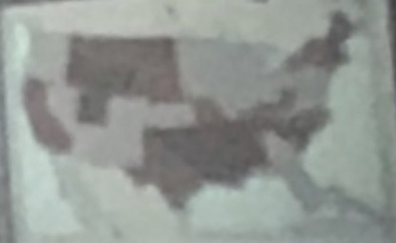
Here’s a closeup of what Gilead appeared to look like in Season 2, based on a very fuzzy map. As we now know Texas is NOT controlled by Gilead, we can see that California also wasn’t controlled, so there’s a lot of continuity with the current season. However, there are also quite a few differences.
After Season 2 Episode 11 aired, Redditor mess_is_lore redrew the maps for clarity, as best they could determine.
[Spoilers S2E11] Redrawn Map for clarity from TheHandmaidsTale
As you can see, these differ quite a bit from the official Season 4 map. But all of that changes if you refer to the map revealed in the Season 2 finale.
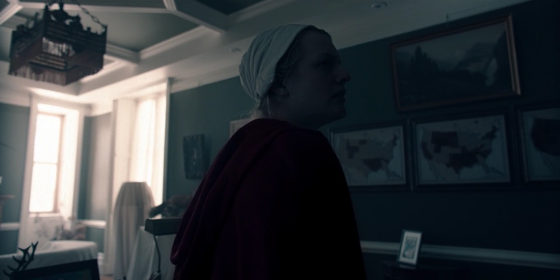
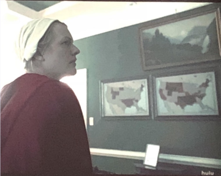
Then in the Season 2 finale, we saw a very clear map in the episode. Fred Waterford’s map was completely different from what we saw in Episode 11.
Did you notice the nuclear signs on the map? There’s an even BETTER map if you want to see it. It’s incredibly similar to the map above, but it was shared by Redditor hashtagtruthbomb after attending the finale in LA.
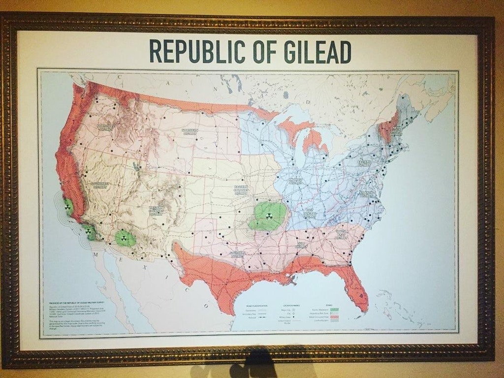
And an even clearer one shared by Redditor tyrell_m.
Zooming in on the legend, it looks like the green areas (and the areas marked with nuke signs) are “Atomic Wasteland.” Then there are areas outside of them marked “hazardous risk zone.” The orangey areas are marked “rebel occupied area.” So you can clearly see that Gilead controls the blueish areas in northeast, which are marked New Gilead District, the Eastern District, the Atlantic District, the Midwest District, and East Central District. Then the pinkish areas are also Gilead controlled: Northwest district, Northern district, Southern district, Gulf district, and South East district. Then there are the yellowish areas on the map, which are colonies: Eastern Colonies District, Western Colonies District, and Southwest District. And it appears the black dots are Gilead military bases, which could explain how they were able to get oranges from Florida.
It’s interesting to note how different things are since this map was widely shared. It looks like Texas rebels took over the entire state when they didn’t originally have that much land. However, it seems like some land that was rebel-occupied is now disputed in the Florida region. So the maps are still very similar, but some things have changed in the course of two seasons.
Want to chat about The Handmaid’s Tale? Join our Discord server here. You can also follow us by email here or in our Handmaid’s Tale Fanatics Facebook page.